Benefits of 3D-PAWS
The Need for Automatic Weather Stations (AWS)
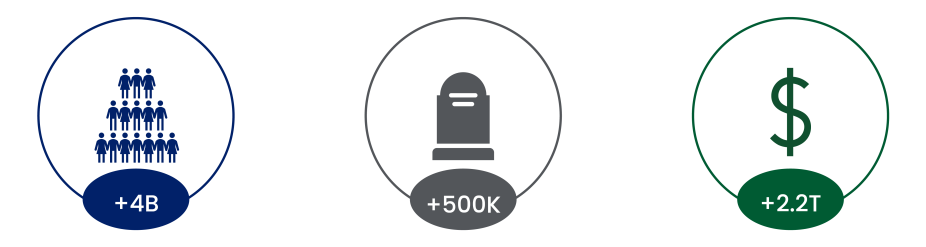
Between 1999 and 2018, hydrometeorological disasters affected more than 4 billion people globally, caused more than 500,000 deaths, and resulted in an estimated $2.2 trillion in economic damages (source). These events often devastate communities in rural and data-sparse regions.
Expanding the density of observation in rural areas saves lives and livelihoods. Increasing the number of automatic weather stations (AWS), particularly in data-sparse, remote regions provides observations to create higher resolution regional forecasts and provide improved early warnings of high-impact weather events.
Current AWS Challenges
The number of automatic weather stations (AWS) in remote regions is slowly growing, facilitating more localized weather forecasting and earlier warning of high-impact weather events. However, National Meteorological and Hydrological Services (NMHS) in many rural areas lack the funds or human resources to purchase, install, operate, and maintain equipment on a wide scale.
Without proper financial and service support, AWSs are often operational for a short period but—due to a lack of support, spare parts, and maintenance—will eventually fail without any mechanism to repair the station.
3D-PAWS: A Low-cost, Sustainable Solution
To expand observation networks, the COMET developed the low-cost, high-quality 3D-PAWS through funding from the US National Weather Service (NWS) International Affairs Office (IAO).
3D-PAWS provides a low-cost, sustainable solution for expanding weather observation networks.
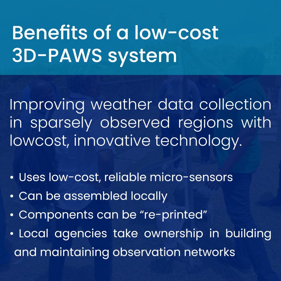
The 3D-PAWS initiative was designed to overcome the main roadblocks for expanding weather observation networks: cost, sustainability, and human resources.
Cost: 3D-PAWS uses low-cost, reliable microsensors and components that can be fabricated locally for a cost of $400-500 USD.
Easy maintenance: The parts for 3D-PAWS can be quickly “reprinted” for easy replacement if lost, stolen, or broken.
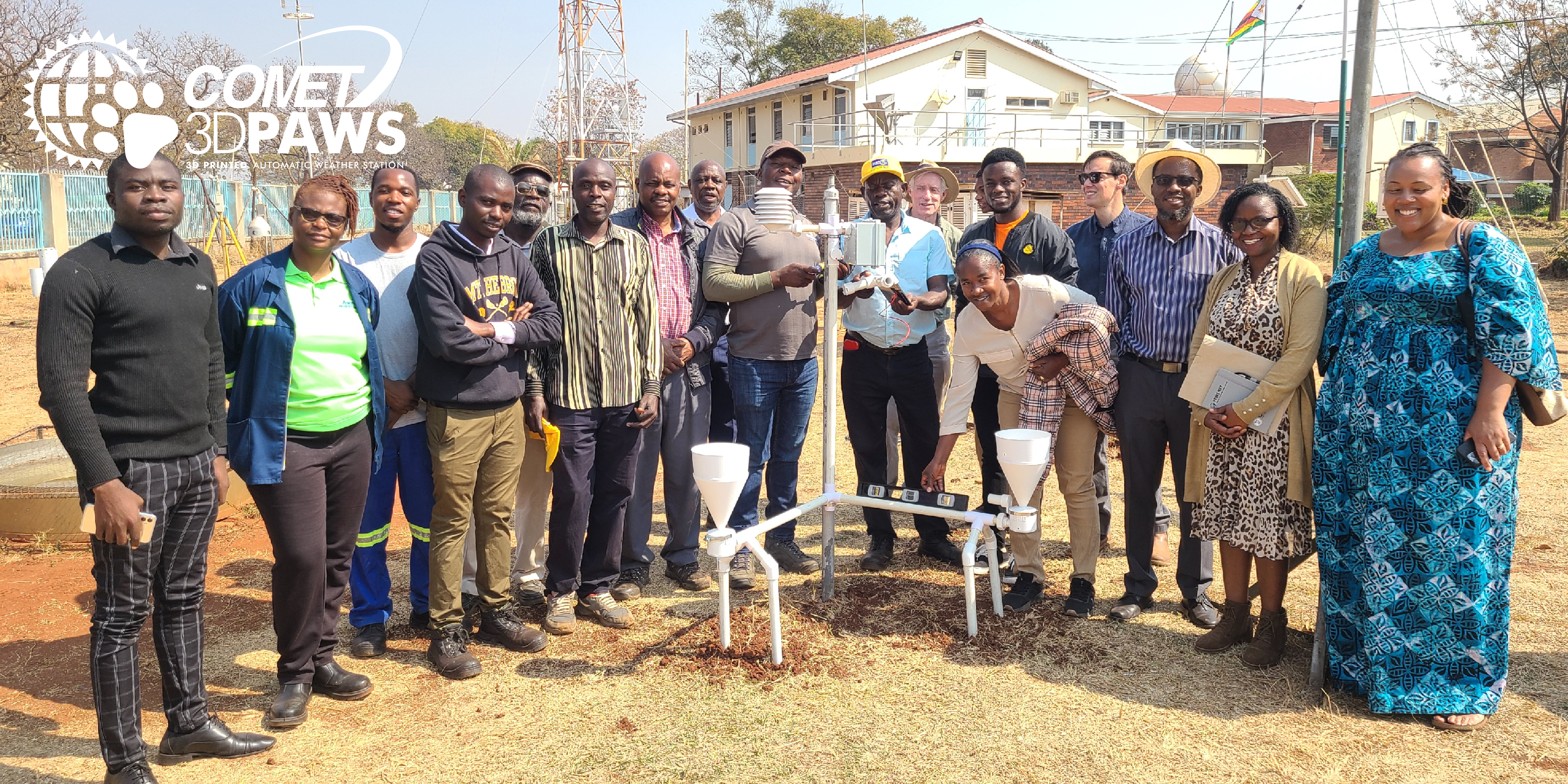
Human resources: The COMET ICDP provides customized training, manuals and documentation, and other resources to enable local agencies to take ownership in building and maintaining their 3D-PAWS.
The system uses a Raspberry Pi single-board computer for data acquisition, data processing, and communications. Real-time sensor data is available on the Cloud-Hosted Real-time Data Services for Geosciences (CHORDS) project data servers and is accessible to anyone at anytime.
3D-PAWS is uniquely designed with data-sparse communities in mind. It allows forecasters and emergency managers in these countries access to critical hydrometeorological information to make sound decisions pertaining to weather hazards.