Search
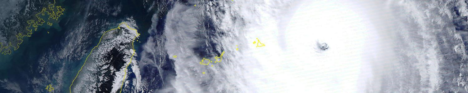
Basic Satellite Imagery Interpretation
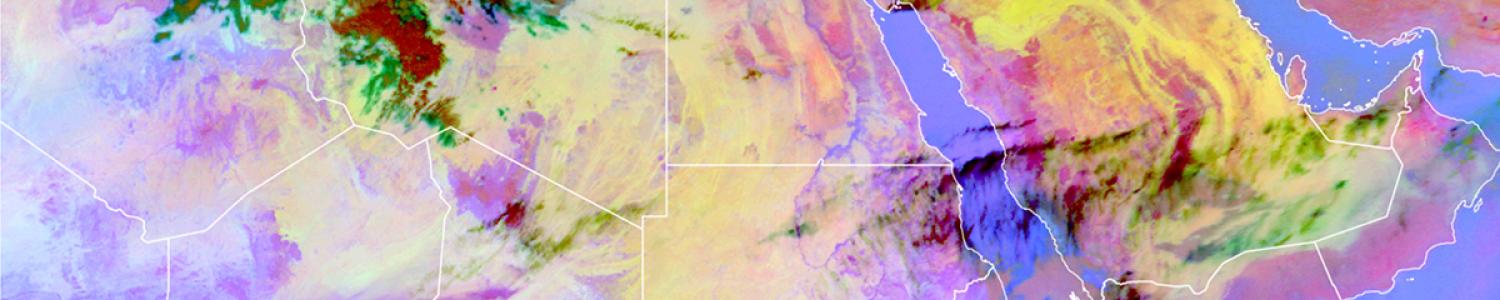
Basic Satellite Imagery Interpretation
About this training lesson
COMET's online learning platform, MetEd, is recognized internationally for the value its training lessons provide. These lessons often rely on guided interpretation of data to teach concepts and skills. The MetEd lesson Basic Satellite Imagery Interpretation teaches the basics of weather satellite image interpretation, with an emphasis on the African region. Learners identify atmospheric and surface features using three basic satellite channels and common RGB products. See below how two of these, the water vapour channel and the severe convection RGB, are introduced. The exercise afterwards uses an interactive comparison widget to help learners identify cloud heights.
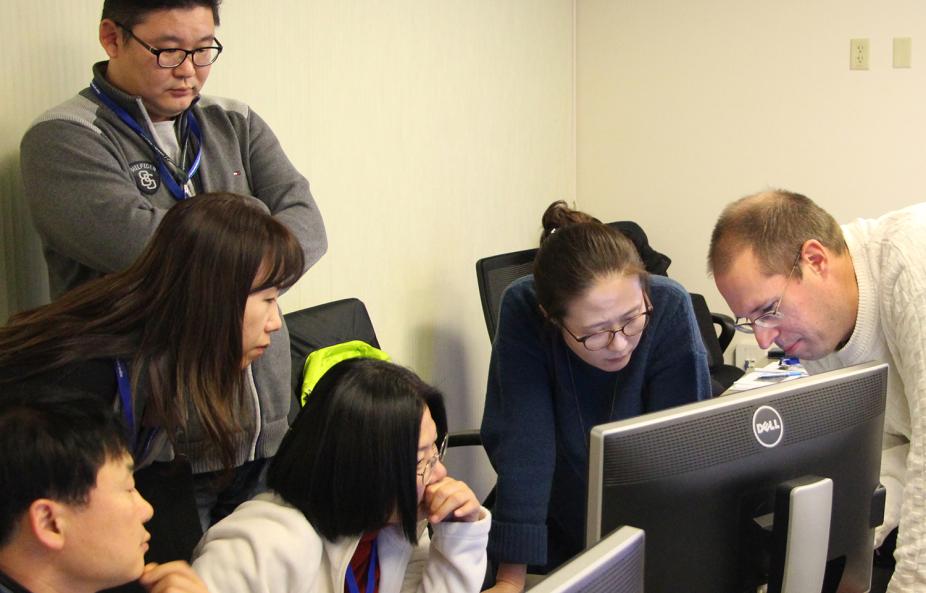
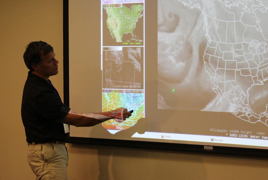
KMA Weather Analysis Course
KMA Weather Analysis Course
About this facilitated course
Working with experts from universities and national science agencies, COMET staff scientists design and deliver many customized residence courses each year. The KMA Weather Analysis course, held in December 2017 at COMET's facilities in Boulder, CO for Korea Meteorological Administration staff, featured lectures, interactive labs, and discussions on many weather analysis, diagnosis and prognosis topics. Students experienced satellite products on a synoptic scale by building the atmosphere in 3D with Play-doh down to hydrometeor classification with dual-polarization radar in real-time with experts in the field. This course covered analysis at all scales. Such courses offer forecasters the opportunity to shadow experts and apply new methods with peers in an environment that simulates the work experience.

Recent testimonials highlight just how valuable our facilitated courses are for increasing geoscience professionals’ skill and capacity:
Very engaging presenters ... gave me tools I can use in the office. The activities did get me thinking without making it too easy, helping ensure I learn and internalize the information better.”
“The water vapour discussions were a key component of the daily activities and gave me a deeper understanding of what is driving the sensible weather in 3D.”
“When I came on shift... the surface analysis didn’t make sense and fronts were misplaced... I demanded a rethink of the evening's analysis [using new course knowledge], and we came up with a better solution.”
How Typhoon/Mountain Interaction Influences Precipitation Distribution
How Typhoon/Mountain Interaction Influences Precipitation Distribution
About this animation
COMET animations communicate scientific concepts visually. The ones below were designed to help learners see how the relationship between Taiwan's Central Mountain Range and a typhoon’s circulation, structure, and intensity influence precipitation distributions across the island. They are included in the MetEd lesson Typhoon QPF in Taiwan, which introduces the typhoon QPF forecasting methodology used by Taiwan's Central Weather Bureau.
Impacts TAF Board Videos

Impacts TAF Board Videos
About these training videos
COMET produces many kinds of training aids. This series of short videos, produced in collaboration with NOAA and the FAA, introduces the new Impacts TAF Board tactical decision aid. The first video, "Introducing the Impacts TAF Board", shows how this aid helps aviation professionals easily monitor when and where airport operations will be impacted by the weather. The second video, "Using the Impacts TAF Board", explores the Impacts TAF Board website and explains how to use the key elements of the board.
Solar Event Timeline
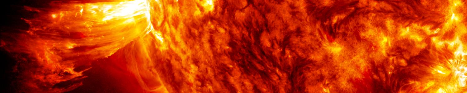
Solar Event Timeline
About this informational video
COMET creates short informational videos for publication on its YouTube channel. This one shows a solar flare and what happens following the event, including the timeline of solar emissions, issuance of warning products, and impacts on Earth. It is based on a real event that occurred on Jan 22, 2012.
COSMIC-2: New Generation Atmospheric Sounding Capabilities
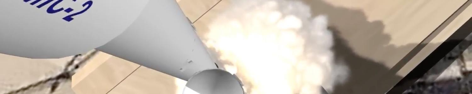
COSMIC-2: New Generation Atmospheric Sounding Capabilities
About this informational video
COMET produces artistic renderings of future processes and events. In 2018, the joint U.S./Taiwan radio occultation mission FORMOSAT/COSMIC-2 will launch six satellites into low-inclination orbits, which will greatly increase the number of atmospheric and ionospheric observations being made. This video provides an introduction to the Constellation Observing System for Meteorology, Ionosphere, and Climate (COSMIC), including information about the COSMIC-2 mission.
Cloud Types and Weather Symbols

Cloud Types and Weather Symbols
About this drill
COMET drills help learners hone desired skills. The drill below helps learners memorize cloud types and weather symbols. It adapts as the learner progresses, showing more of what the learner has missed. It is part of the MetEd lesson Weather Observing Fundamentals, which details standard procedures for taking accurate weather observations.
Climate Drivers and Australian Climate
Climate Drivers and Australian Climate
About this data viewer
COMET designs interactive data viewers to facilitate engagement and learning. The example below allows learners to compare the influence of various climate drivers on Australia’s climate at different times of the year. It is taken from the MetEd lesson Interpreting Climate Outlooks: An Australian Example, which teaches learners to interpret climate outlook maps for rainfall and temperature, and use those maps to inform climate-sensitive decisions.
Hydrologic Impacts Under Climate Change (HIUCC)
Hydrologic Impacts Under Climate Change (HIUCC)
About this facilitated online course
Periodically COMET produces online, instructor-led training for specific groups of learners. In this three-day course for water resource professionals, state/local planners, and hydrologists, participants worked with hydrologic models and climate change scenarios to assess impacts of a changing climate on surface water hydrology. Using sample watersheds, participants also learned how to evaluate climate change questions across different time and space scales. The following is Part One of a three-part lecture given by Holly Hartmann, PhD, during the course and available online in the MetEd lesson, Communicating Climate Change Scenarios with Decision Makers.